-

-

-
 Hotel RefreshHotel Refresh
 -

-

-

-

-

-

Matukat Construction
Colorado
2034
350 acres
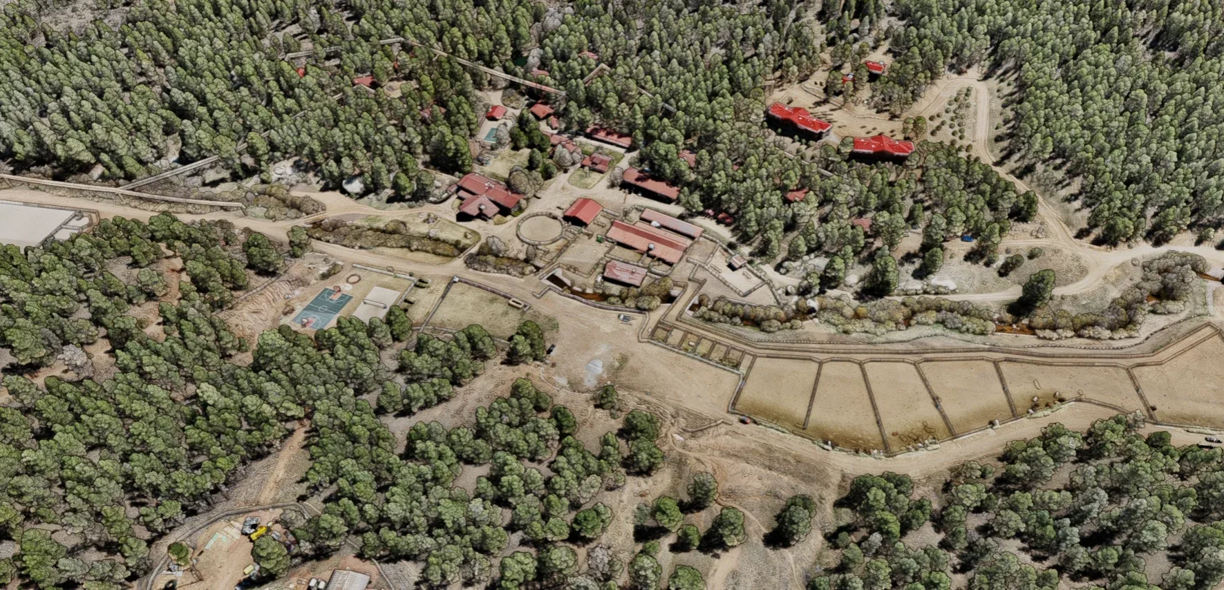
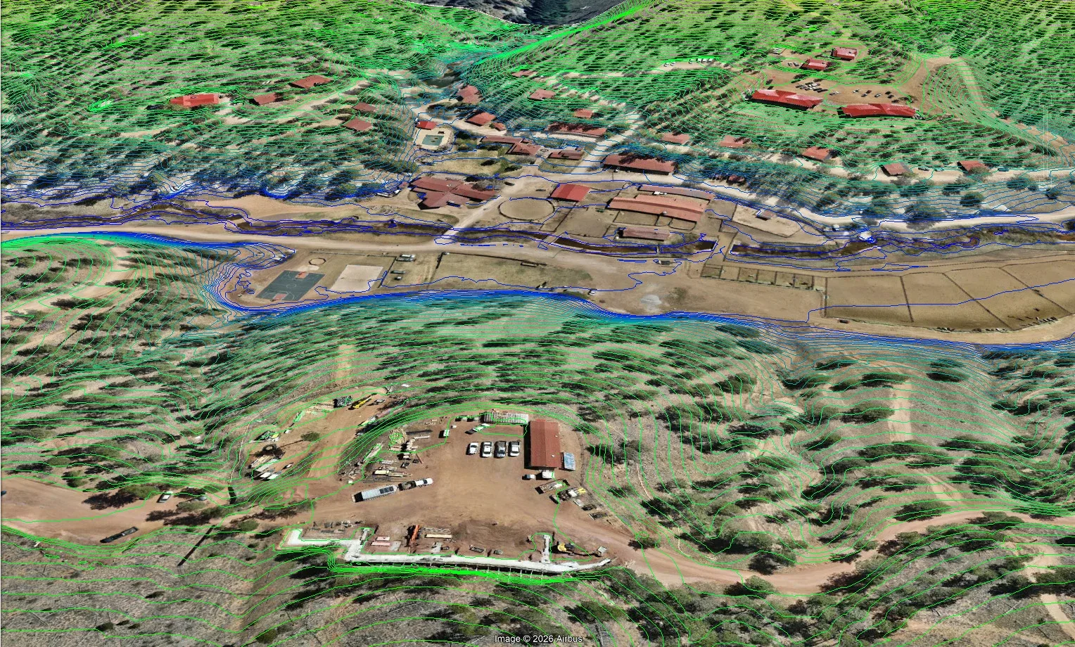
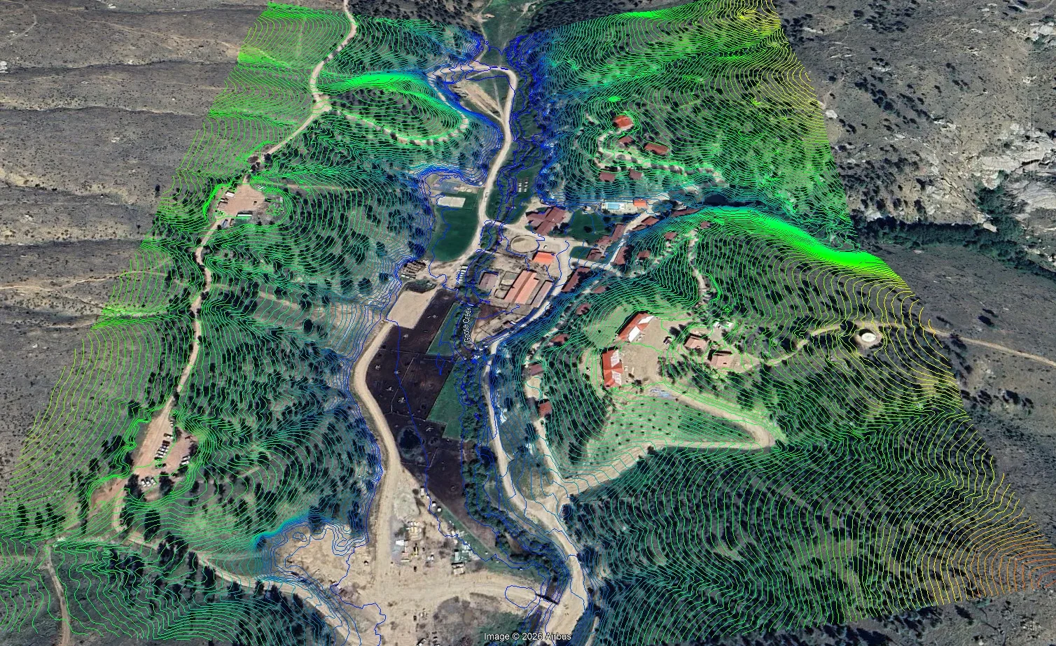
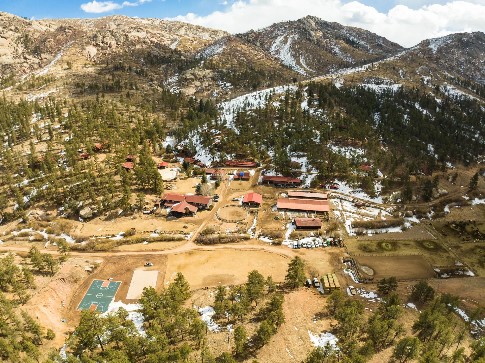
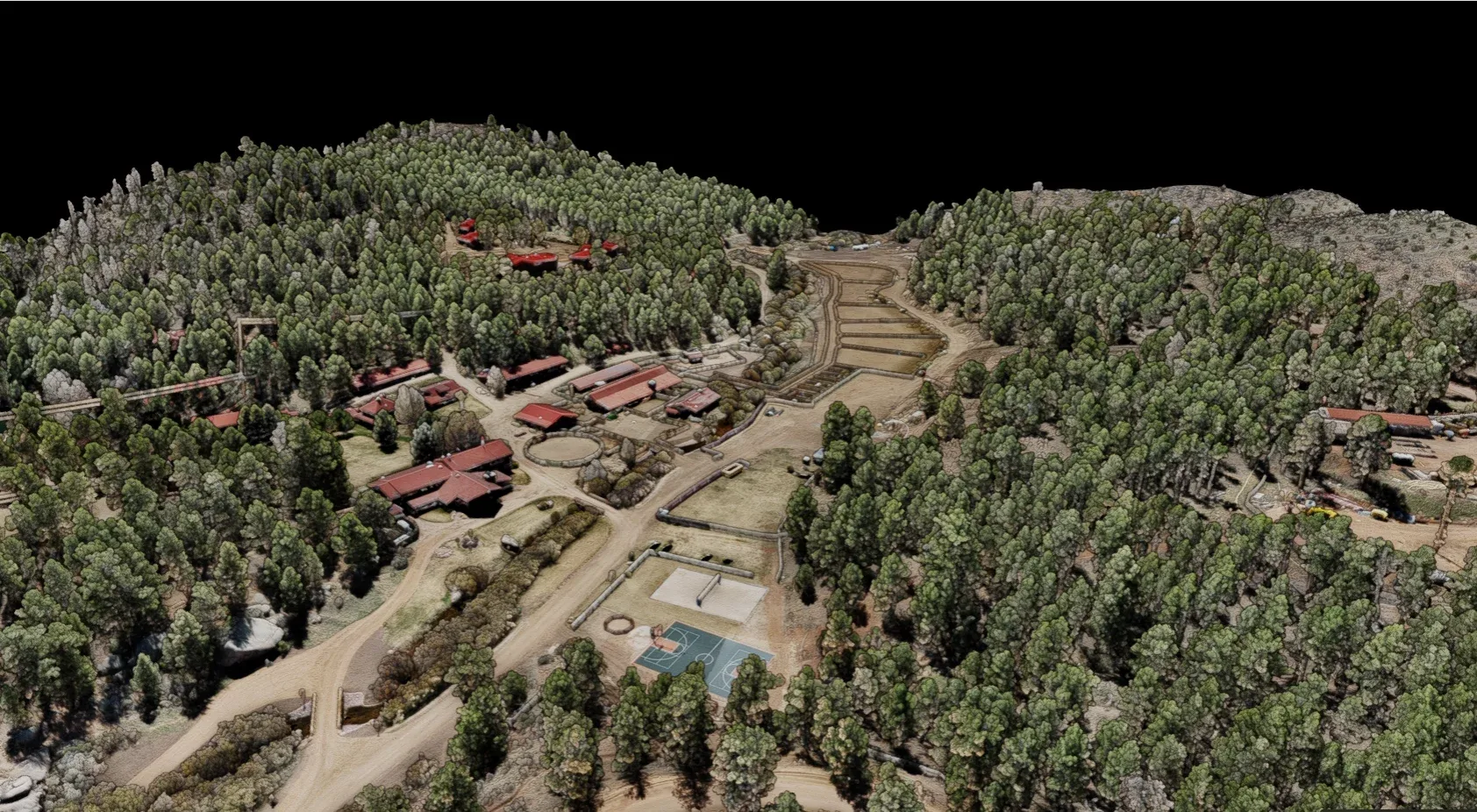
Galloway is providing multidisciplinary services for a large-scale, full-site phased update of an all-inclusive 350-acre ranch in Colorado over the next several years. Our survey team completed a comprehensive topographic survey of approximately 145 acres of the 350-acre ranch using a combination of drone-mounted LiDAR and photogrammetry, GNSS receivers, and conventional ground-based survey methods. The team deployed a high-precision LiDAR sensor and high-resolution camera on a multi-rotor unmanned aircraft system (UAS) to capture highly accurate aerial data across the site, achieving horizontal and vertical accuracies of ±0.08 feet and imagery with a ground sampling distance of approximately 0.55 inches.
The collected data was processed to create a classified LiDAR point cloud, digital surface and elevation models, and a high-resolution georeferenced orthomosaic. These deliverables provided the foundation for mapping terrain and existing features, including cabin and structure footprints to preserve historical buildings, improved and unimproved roads, and vegetation throughout the property.
Within an approximately 11-acre defensible space area, Galloway conducted detailed tree mapping to support wildfire mitigation planning. Using LiDAR and supplemental ground survey, the team located and documented coniferous and deciduous trees greater than 2 inches in diameter, as well as pre-marked trees identified by the client. Additionally, our team conducted a bathymetric survey of the outflow pond for dredge analysis.
Final deliverables included a tree topographic survey, CAD and point files, LiDAR point clouds, orthomosaic imagery, and all supporting raw data and field notes, providing the client with a robust dataset to guide planning and design efforts across the ranch.