 Cost and time efficiency are arguably the most important aspects of a project. With our land survey team’s new drone, the WingtraOne Gen II, we can provide highly detailed survey data for project sites of varying sizes in significantly less time and for a lower cost than traditional or alternative methods.
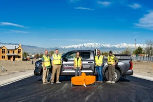
“The drone is faster, more efficient, and you will get more detail than you would if you shoot it conventionally,” said Troy Kendall, survey project manager and HDS & drone manager at Galloway. “Our drone is the Cadillac of all drones right now.”
Galloway is one of only three companies in Utah that offer this fixed-wing drone service, and we have already conducted flights for over 70 projects since purchasing the drone in March of last year. Currently, we have nine licensed drone pilots in Utah and Colorado with clearance to fly in most airspaces.
Unlike its comparable counterpart, the DGI Matrice, the WingtraOne, is approved by the Department of Defense (DOD). This is especially advantageous for project site access because many, especially government sites, prohibit drones that are not DOD approved. This was the case for our survey in Green River, Utah.
With the drone’s ability to fly 500 acres in an hour on just two batteries, we surveyed the entire 4.5 square mile city in just 1.5 days and captured 10,000 high-resolution images. Had the site been surveyed using GPS, it would have taken two to three months and cost twice as much. The drone has benefited several additional projects, such as our Walmart program, where the drone surveys the 26-acre sites in just seven minutes.
Once the thousands of photos are captured, the drone software compiles them into one image placed in the real-world using ground controls and our coordinate system. The imagery provides details like asphalt and bridge rehabilitation and brake lines. A surface is then created, with buildings, trees, etc., automatically taken out for a more accurate surface and put into CAD for our civil team to design from.
“We can change the grid on the drone software to collect X, Y, and Z values on anything. I can set a grid at a foot interval and have a data point for every foot on the surface,” said Kendall. “The client can see what is happening and the property’s site conditions. We have noticed that our clients like it when we use the drone.”
In the future, we look to expand our fixed-wing drone services into additional markets.
We are nationally recognized and locally preferred. We would love to work with you on your next project.
Contact Us