Successful development projects and property transactions begin with a clear understanding of the land beneath it. Before a single line is drawn or foundation poured, accurate survey data provides the insight and confidence needed to guide design, schedule, and budget decisions. In engineering, architecture, and development, the quality of the survey can determine the difference between smooth execution and costly delays.
A land survey is the process of measuring and mapping land to accurately define property boundaries, elevations, and existing site features. Modern surveys leverage advanced technologies, including GPS and GNSS receivers, robotic total stations, drones (UAS), and 3D laser scanning to collect precise data efficiently. Survey timelines vary based on the type of survey, site size, terrain, and overall project complexity. By applying the right technology and approach to each project, survey teams can balance accuracy, efficiency, and turnaround time to best support planning, design, and construction needs.
Waiting to involve survey professionals can introduce unnecessary risk. Having complete, up-to-date data has many benefits:
As Reade Roselles, senior survey project manager and principal at Galloway, emphasizes, “The expensive part isn’t the survey. It’s not bringing survey in soon enough. A lot can change in even just a year, and relying on old data can be detrimental to the project.”
When selecting a land survey provider, reputation matters—both in terms of past performance with similar clients and credibility within the survey and AEC community. Experience should align with the specific scope of work, supported by the right mix of qualified personnel, software, and technology to execute the project effectively. Strong providers also bring problem-solving capabilities and a forward-looking perspective, understanding how emerging technologies can add value while anticipating potential challenges. Beyond delivering survey data, the best surveyors act as trusted advisors, taking the time to understand project goals and contributing insight that supports successful outcomes.
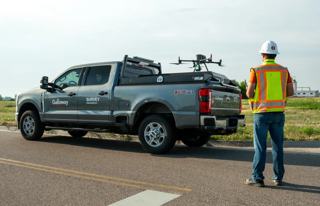
Galloway’s land survey team launches a drone to scan and collect data for a large mixed-use development.
Our team provides land and construction surveying, including ALTA/NSPS surveys and land plats, essential tools for property ownership, title verification, and financing. Using geospatial technology and UAV-based scanning, we capture large or complex sites with unprecedented speed and accuracy.
As James Kessner, Galloway’s UAV and high-definition scanning manager, explains, “We can collect billions of data points in a single flight, then turn that information into models that give clients and design teams an incredibly detailed view of their project.””
Beyond standard surveys, our team offers niche experience, such as bathymetric surveying, across multiple surveying disciplines. Brian Dennis, senior survey project manager and principal at Galloway notes, “Our surveyors come from many parts of the country and specialize in many niches, so there’s a strong probability we have someone who understands your specific type of work.”
At the heart of Galloway’s survey services is a simple principle: deliver quality data efficiently. In an industry where delayed or inaccurate surveys can stall entire projects, the need for responsiveness, accuracy, and clear communication is essential.
Troy Kendall, survey project manager and senior associate at Galloway, explains, “When one discipline excels, the entire company succeeds, the client succeeds. We take that responsibility seriously.”
By fostering a culture of quality and responsive collaboration, Galloway’s survey team provides reliable data and actionable insights, enabling design, engineering, and development teams to make smarter, faster decisions whether for a small, half-acre site, a master-planned development, or projects spanning local to national scales.
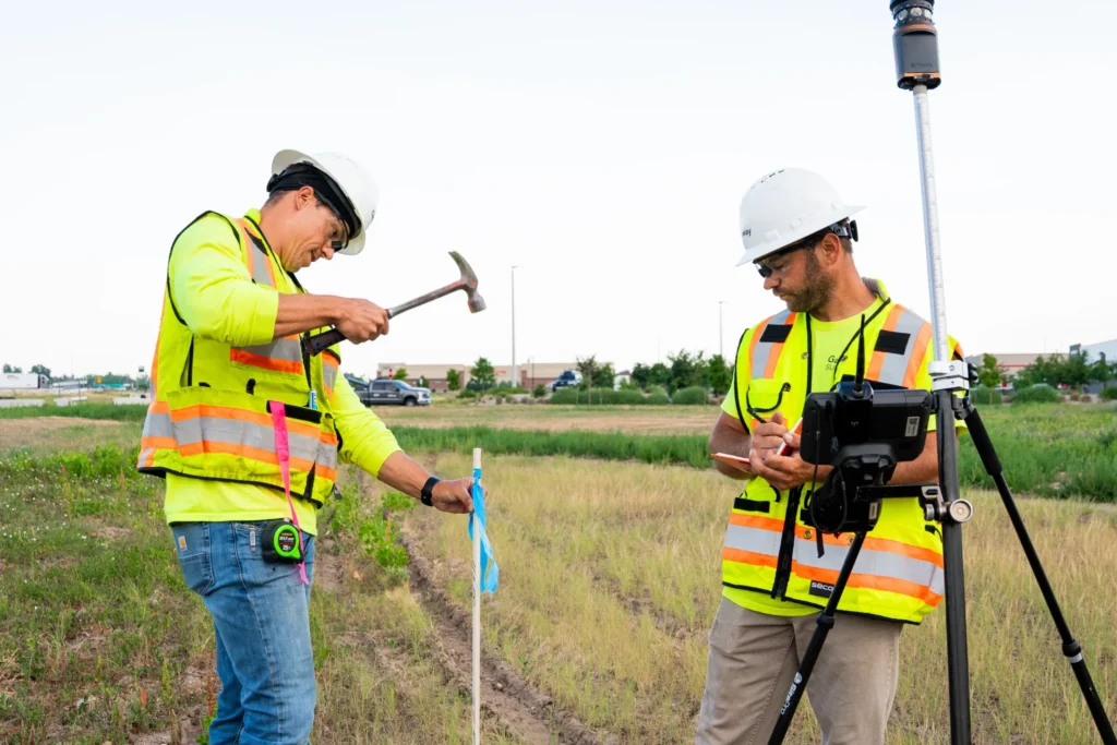
Galloway’s land survey team performs construction staking for a large mixed-use development.
Surveying at Galloway is integrated into our Full Spectrum Approach™, where early collaboration across all disciplines drives better project outcomes. Because surveyors are often the first professionals on site, they can surface insights that extend beyond boundaries and topography, informing civil engineering, architecture, permitting and entitlement, and development strategies.
“When we cross-sell, it’s not just about adding services,” says Reade. “It’s about solving more of the client’s challenges through collaboration.”
Aligning survey data across disciplines from day one reduces risk, shortens timelines, and ensures consistent quality throughout the project lifecycle. Survey becomes a strategic driver of success, not just a starting point.
Complete this form to contact our team.
"*" indicates required fields
We are nationally recognized and locally preferred. We would love to work with you on your next project.
Contact Us