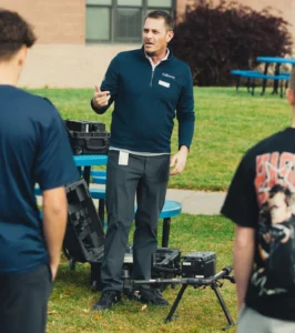
James Kessner educates students on the drone’s capabilities before they take flight.
Leadership in drone and geospatial technology isn’t just measured by the projects we deliver, it is also reflected in how we invest in the next generation of talent.
In a recent partnership with University High School in Greeley, Colorado, Galloway’s unmanned aerial systems and high definition surveying team manager, James Kessner, brought Galloway’s professional-grade drone fleet to the classroom. Students operated the drone equipment and witnessed the real-time creation of orthomosaic point clouds and 3D models, the exact technology that drives our survey and design projects. This advanced drone class, led by Professor John Woodward, is designed to equip students with the skills and knowledge needed not only to earn their FAA Part 107 license but also to build a sustainable, professional career in the drone industry.
Real-World Drone Training and LIDAR Mapping
The flying session was the highlight of the day. Students operated Galloway’s professional-grade drones, including a high-end LIDAR setup, gaining firsthand experience with the precision, capabilities, and responsibility required for professional drone work. They witnessed real-time orthomosaic point cloud creation of their school campus on the drone controller and explored their data through the cloud-hosted 3D modeling software Galloway uses.
This point cloud, built from 197.3 million data points, was created from the students’ drone flight over the University High School campus.
Exploring Careers in Drone Operation
Before taking the controls, James helped design the class syllabus, advised on grants for new drone equipment, and built a curriculum grounded in real industry practice. During a four-hour session, he guided about a dozen engaged students through the resources and knowledge needed to navigate the drone industry, beyond the basic FAA Part 107 requirements. He emphasized that while anyone can buy a drone, turning it into a professional tool and a viable career requires intentional planning and strategy.
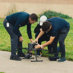
James Kessner guides University High School students as they operate the drone.
The first half of the class introduced students to the top industries that use drone technology, ranging from emergency response to creative photography and architecture, engineering, and construction (AEC). James explained the types of drone platforms, technology, techniques, and business approaches used in each industry, as well as leading companies in each sector. He also provided guidance on internships, shared firsthand lessons learned, and offered a roadmap for entering the drone industry in a sustainable way.
Inspiring Future Surveyors
The response from students was overwhelmingly positive and the program was so successful that James will return for additional sessions this year where the students will further dissect the models and learn how collected data translates into actionable insights and continue the program next year. James’s favorite moment was watching students experience the “Aha!” moment of seeing hundreds of images transformed into a precise map or 3D model in real time.
This experience highlights a powerful opportunity to attract the next generation to the surveying and geospatial fields. Today’s students are naturally drawn to technology, and surveying has evolved into a truly technology-driven profession. By connecting their existing interests with real-world applications, programs like this spark curiosity, build confidence, and plant the seed that a future in surveying is both attainable and impactful. At the same time, they help foster a deeper appreciation for community engagement and the meaningful outcomes that come from investing time in the next generation.

About James Kessner
James Kessner has more than 24 years of experience in land surveying, remote sensing, and aerial mapping. Starting his career as a rodman and growing into a program leader and business owner, he has built and managed advanced UAS and LiDAR programs across the industry. He has led multi-million-dollar surveying and mapping projects, managed complex initiatives like the Gateway South Transmission Line, and developed high-performing teams of pilots, sensor operators, and data scientists. James has also authored industry-leading UAV and terrestrial SOPs, pioneered LiDAR and photogrammetry workflows, and driven more than $30 million in proposals while securing key MSAs across the power, renewable energy, and oil & gas sectors.
As Galloway’s UAS & HDS team manager, James leads geospatial efforts, advancing technology adoption and delivering innovative solutions for clients. He is driven by a passion for empowering teams, sharing knowledge, and pushing the boundaries of what’s possible in remote sensing.
We are nationally recognized and locally preferred. We would love to work with you on your next project.
Contact Us